
Photo: NOAA
Cyclone Fantala is now the third storm in the last six months to reach the “strongest on record” classification. Most recently, Tropical Cyclone Winston tore through the South Pacific as the strongest that had ever been recorded there. Before that, Hurricane Patricia was the strongest ever recorded in the Eastern Pacific.
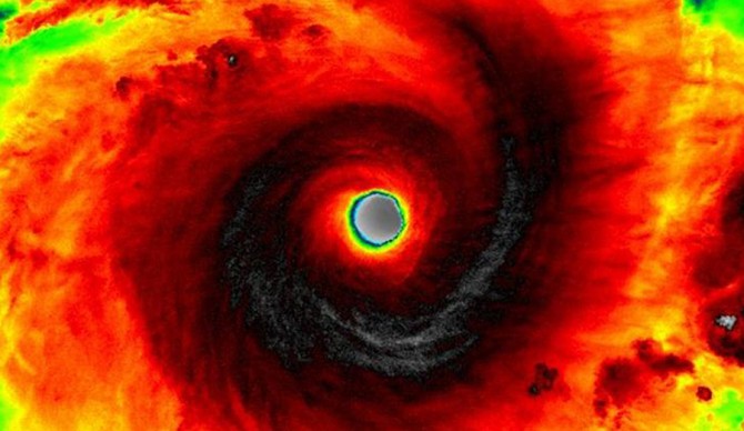
Unlike Winston, fortunately, Fantala’s track over the Indian Ocean has the eye of this very intense cyclone steering wide of landmass as it travels well off the coast of Madagascar. Forecasters say even if it does make landfall on Madagascar, by the time it does, the storm will be significantly weakened. On Monday the storm passed over the Seychelles island chain, but it left nothing more than some structural damages and no injuries. It’s been the most significant blow dealt out by this particular (formerly) Category 5 cyclone. Nonetheless, the 16-nautical-mile-wide eye is an impressive sight. Aside from that, it churned out 175 mph winds over the weekend before weakening to 160 mph winds by Monday evening (U.S. time), equaling the strength of a Category 5 hurricane on the Saffir-Simpson Hurricane Wind Scale.
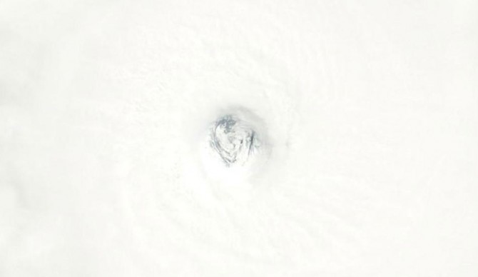
An image from NASA’s Terra satellite zooms in on Fantala’s eye Sunday. Photo: NASA
By Tuesday morning Fantala was weakening with winds closer to 105 knots and tracking to the southeast before it’s expected to make a U-turn for Madagascar. On the surf outlook, Fantala is expected to churn out waves for everywhere from the East Coast of Africa, to Madagascar itself, to Reunion and other islands in the area.
