
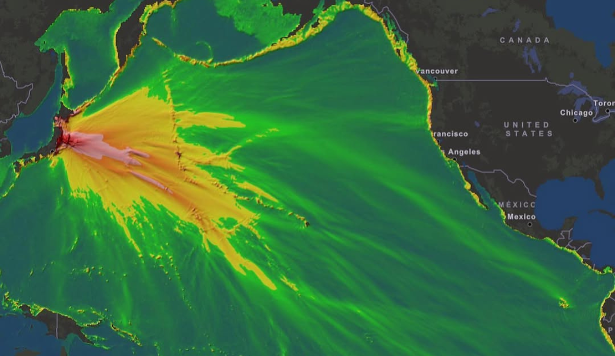
A NOAA Energy Model illustrates the magnitude 9 earthquake that struck Tohoku, Japan, on March 22, 2011. Image: NOAA
Just how big was last week’s earthquake that hit Russia and created a tsunami that dispersed energy throughout the entirety of the Pacific Ocean? At magnitude 8.8 on modern seismic instruments, it landed in the top-10 strongest earthquakes recorded. That made it the largest quake since a magnitude 9 earthquake hit Japan in 2011, which created a tsunami with waves ranging from six feet to as much as 128 feet tall.
For comparison’s sake, the NOAA provided energy models of several similarly massive earthquakes dating between the mid-18th century all the way up to that 2011 quake in Japan. The energy maps are fascinating. The 1755 earthquake near Lisbon, Portugal, for example, shows tsunami energy dispersed mostly in a narrow beam to the northwest.
The M8.6 quake off Unimak, Alaska in 1946 created a similar looking energy model that shot down to the south and eventually bends around the southern tip of Chile. Chile’s 1960 M9.5 quake, meanwhile, spread throughout the entire Pacific Ocean. Even the strongest tsunami energy (displayed in red and pink) stretched past Hawaii nearly 7,000 miles away. That tsunami “scattered debris, gutted foundations, with parking meters that were bent parallel to the ground by the force of the waves,” as far as Hilo and beyond the NOAA says.
View this post on Instagram
