
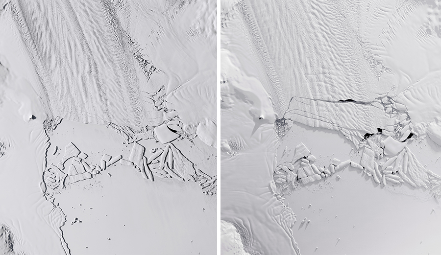
NASA satellite imagery shows a before and after of an iceberg, the size of Atlanta, calving off Pine Island Glacier in Antarctica. Photo: NASA
The “melting of the polar ice caps” is one of the central concerns of scientists, environmental activists, and policymakers all trying to mitigate if not reverse the effects of climate change on our planet. To paint the problem in broad strokes, as glacial ice calves falling into the sea, it melts and the aggregate amount of water in our oceans increases. The result is, among other things, rising sea levels, which can have a detrimental impact on coastal areas. NOAA explains that nearly 40 percent of Americans, for instance, live in coastal urban areas at risk of increased storm surge, and flooding.
According to NASA, this phenomenon appears to be happening more frequently, particularly at Pine Island Glacier in West Antarctica.
“[The glacier] is known for dispensing icebergs into the Amundsen Sea, but the frequency of such events appears to be on the rise,” said NASA in an article on the organization’s blog, Earth Observatory.
In October, the article explains, scientists at NASA watched 300-square-kilometers of ice separate from the glacier in chunks, the largest iceberg, named B-46, was 226-square-kilometers, roughly the size of the city of Atlanta. Researchers say this sort of phenomenon that used to happen around every six years is now happening annually.
“The calving of B-46 is the latest in a string of near-annual events; Pine Island Glacier has shed icebergs in 2013, 2015, 2017, and 2018. (The 2015 icebergs calved amid the darkness of austral winter.) Prior to 2013, such events happened about every six years.”
According to Joe MacGregor, glaciologist and project scientist for NASA’s Operation IceBridge, the increased frequency is likely due to a thinning ice shelf – a byproduct of a warming planet.
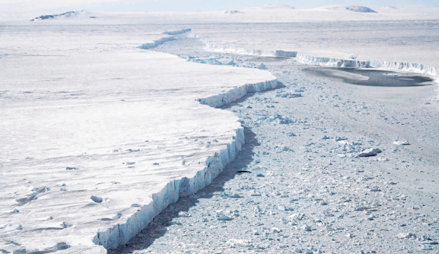
An on-the-ground photo of the iceberg (left) and the glacier (right) gives a better idea on the scale of the event. Photo: NASA
