
Photo: Alert California//UC San Diego
Many people closed the books on California’s winter snowpack saga on April 1, when officials measured abysmal snowpack levels on the critical date which usually marks the point where all accumulated snow begins to melt off. It was no surprise when California’s Department of Water Resources (DWR) reported record lows, revealing that the statewide snowpack sat at just 18 percent of its April 1 average.
It almost seemed cruel when a storm brought snow to the Sierra Nevada and the few ski resorts in the state still open. Palisades Tahoe, for example, enjoyed more than three feet of powder just before the midway point of the month and looked like it was in the dead of winter.
“Mother Nature hit the reset button yesterday,” said resort PR on Monday.
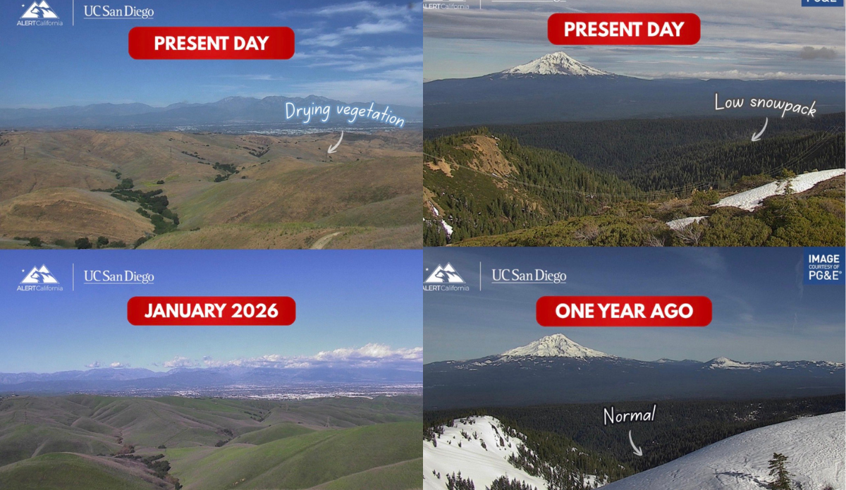
Even if that’s the case at high elevation, it turns out the statewide picture has actually gotten worse. According to CAL FIRE Chief Joe Tyler, the statewide snowpack has dropped significantly and hit “a new record low” by sinking to as little as 10 percent. Tyler tweeted some images comparing last year’s April snowpack to this year’s, as well as another two images that showed the already depleted January snow cover in another area alongside the same dry and empty hills this month.
#California‘s snowpack is at 10–20%, a new record low. That number matters more than most people realize.
When the snowpack is low, that moisture disappears faster. Vegetation dries out weeks earlier than normal, and the drier the grass and brush, the easier it ignites, and the… pic.twitter.com/LjNy1ULcXa
— CAL FIRE Chief (@CALFIRE_CHIEF) April 16, 2026
