
Photo: Direct Weather
A handful of factors are contributing to the current forecasts for this upcoming winter, with a short-lived La Niña on the horizon playing a major role. Who’s going to get dumped on? Who’s going to be pining for powder days? But this time of year — the end of summer in the Northern Hemisphere — always lends itself to the anticipation of who’s going to get snow first?
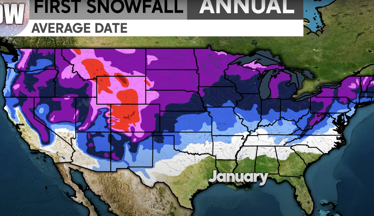
Powder hounds already know parts of Colorado, for example, have seen some dusting here and there. But what about the kind of snowfall that reminds us snow is here to stay? Direct Weather, which takes regular deep dives into meteorology across the spectrum and often provides useful forecasts, brushed off all the potential outliers like La Niña this week and simply looked at statistical averages for the first real snowfall of each season.
According to Direct Weather, fewer than one percent of people live in areas and elevations where the first snowfall is expected by early October. The small red blobs he uses to highlight these areas covers some of the higher elevations in Utah, Montana, Wyoming, and Colorado. That’s right around the corner. Parts of the Cascades typically follow later in the month.
“As we continue on and take a look at the early November region, you can see that now we are talking about a lot more folks (seeing snow),” Direct Weather continues. “We see pretty much all of the mountain ranges out West now involved and included in their first snowfall by that first half of November.” A majority of the Northern Plains, the upper Midwest, and the Great Lakes are also experiencing their first snowfalls and/or accumulating more snow overall. Meanwhile, the Northeast starts to get into the mix.
Late November is typically when (more) lower elevation areas start to see the first snowfall — a full month before winter solstice hits. Not much changes by early December, but the second half of the month gets more interesting, when we officially enter the winter months.
