
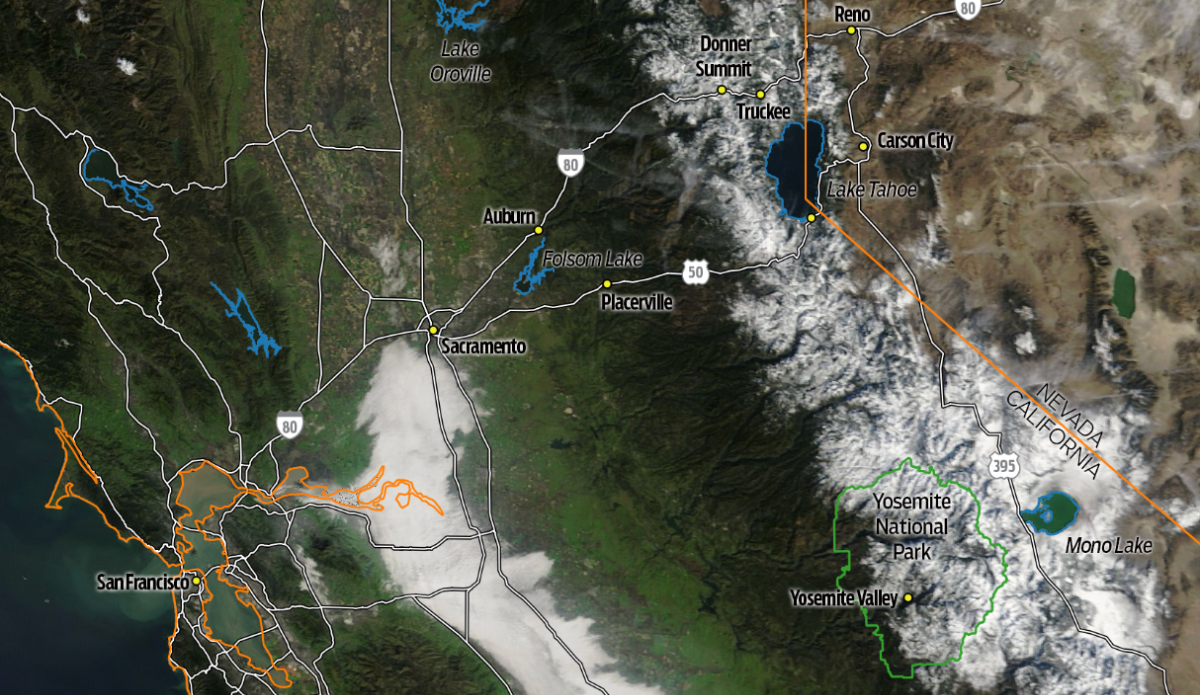
Satellite image over the Sierra Nevada range on Feb. 5, 2026. Photo: NASA Worldview
California’s snowpack at the beginning of the new year was only slightly below average, sitting at 93 percent of its historical average on January 6. But by the second week of Febraury that number had dropped to just 55 percent of its historical average.
Now, after a massive storm ripped through the West Coast and dumped snow on the Sierra Nevada, that number has climbed up to 73 percent (on Monday, February 23). That’s one rollercoaster of a winter, highlighted by dry and warm stretches with intense storms sprinkled in throughout the season.
Recent satellite images shared by NASA illustrate just how drastic this latest swing has been. One image shows the Sierra Nevada on February 5, 2026, just as the region was falling toward that 55 percent mark. A second image from February 22 looks like an entirely different mountain range
To give some perspective, the University of California’s Central Sierra Snow Lab near Donner Summit recorded 111 inches of snow (more than nine feet) between February 16 and February 20. The lab reported that is the most snow to fall over a five-day period since a 118-inch dump in 1982. Another storm in 1970 narrowly edged this recent one out with 113 inches of snow falling over the same span of time.
“Moderate snowfall rates are continuing with snow-to-liquid ratios of ~12:1, which means lighter and fluffier snow than we normally get,” the lab wrote on February 16.
Are we due for a Miracle March?
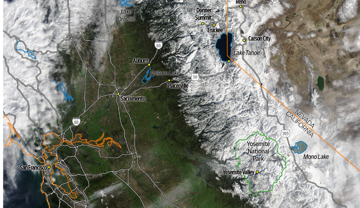
Satellite image over the Sierra Nevada range on Feb. 22, 2026. Photo: NASA Worldview
