El Niño doesn’t deliver a one-size-fits-all winter for skiers and snowboarders. The natural climate phenomenon has impacts that reveal themselves in different ways across each part of the globe. And that inevitably leads to the frustrating search for answers to a simple question: What does El Niño mean for me?
How much snow will fall in this region? What will the waves be like in that region? While forecasters are very confident this 2026-2027 El Niño is going to be a particularly strong one, their predictions about how much snow, rain, or waves that entails is largely built on tracking historic data of past El Niños.
California ski resorts, for example, started marketing the upcoming El Niño as soon as we were made aware one was on the way, and they’ve continued to build on the daydreams of deep powder days, massive snowfall totals, and a possible lengthy season. Meanwhile, the Pacific Northwest is often the most reliable loser of El Niño winters as far as skiing and riding are concerned.
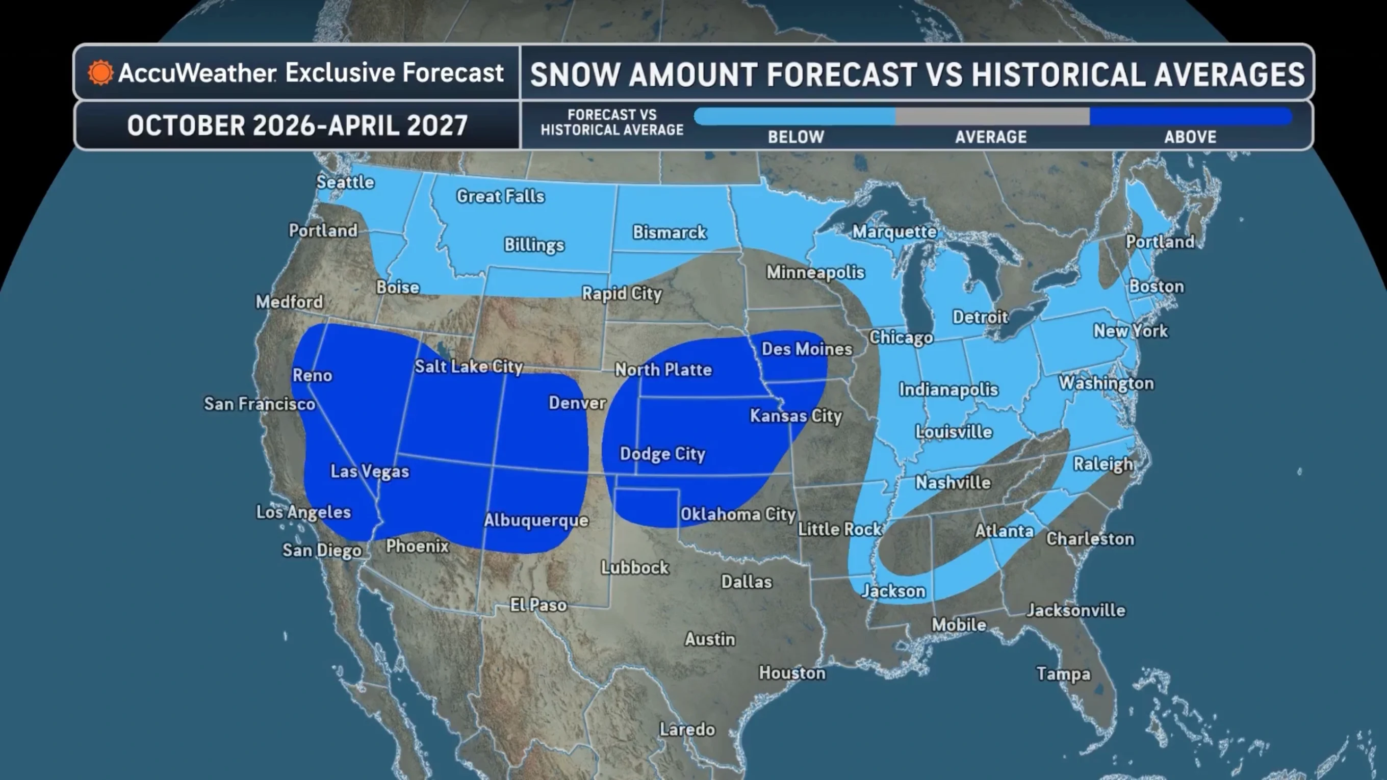
To simplify what that looks like throughout North America, AccuWeather published a map illustrating what your El Niño ski season will likely look like.
“The primary storm track, particularly in the first part of winter, will be across the southern U.S. and leave many areas in the Plains void of snow,” AccuWeather Senior Meteorologist Chad Merrill said. This storm track will also lead to opportunities for snowflakes across the Southeast and into the southern Appalachians.
Should you expect to see more snowfall than usual, less than usual, or about average this winter?