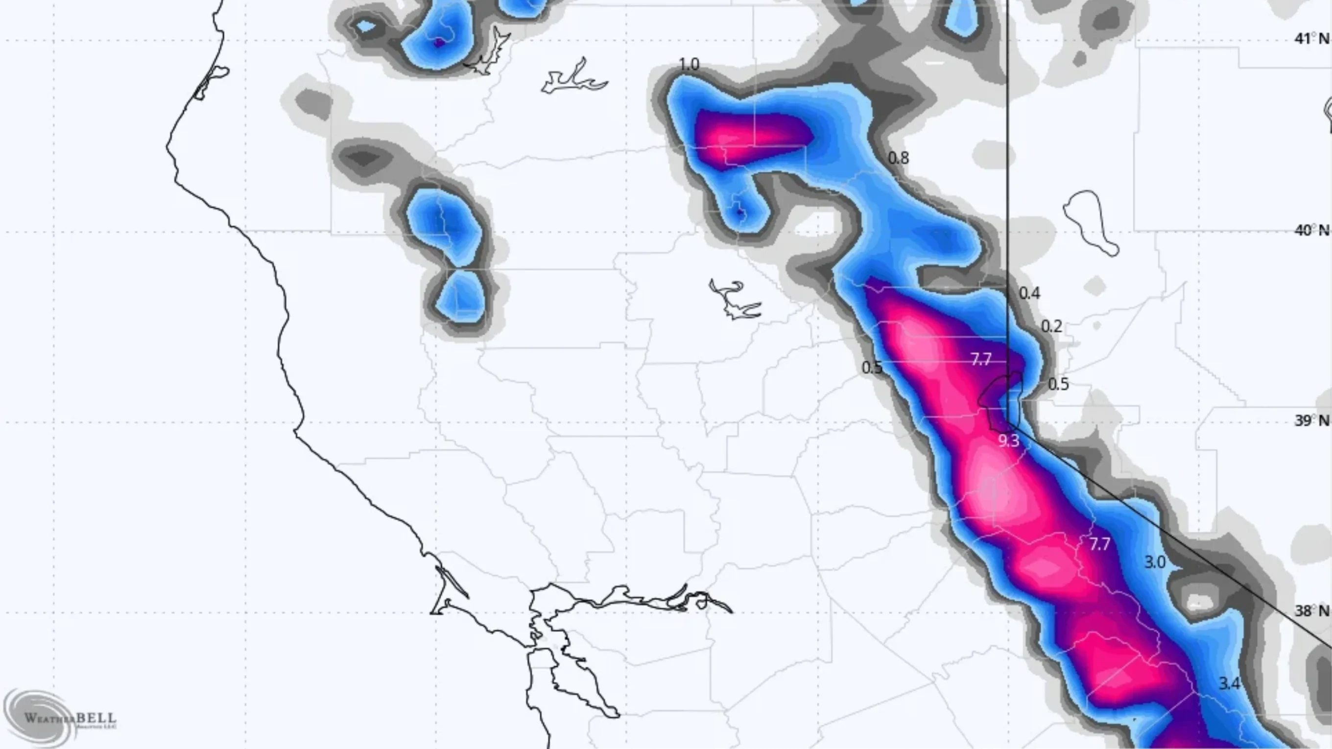
A winter storm warning has been issued for the Sierra Nevada Range beginning Friday. The early-season storm was expected to bring as much as two feet of snow at higher elevations, but those forecasts have tempered as the storm nears.
“Rain, mountain snow, and strong winds are forecast for Nevada County beginning Friday, Nov. 13, and continuing into early next week,” reads a statement from Nevada County Officials. “The National Weather Service (NWS) has issued a Winter Storm Warning for the northern Sierra above 6,000 feet from 10 a.m. Friday through 10 a.m. Saturday.”
Powderchasers says, “the Sierra storm looks intact for double digits above 8K and even some 4-8 inch totals at the bases this weekend,” adding that “The Sierra is likely the highlight from early Saturday morning through midday. Amounts look plentiful above 8K (7-15), and will be lower by mid-Saturday morning with colder air (5500K-Lake Level). If this were mid-winter, the storm would be a marginal chase due to very strong mid- and upper-level ridge gusts (95MPH). Amounts from 6K to 8K likely land in the 5-9 inch range.”
Snowbrains published snow total forecasts for the following California and Nevada resorts:
- Kirkwood – 11-15 in
- Palisades Tahoe – 10-14 in
- Sugar Bowl – 10-14 in
- Mammoth – 9-13 in
- Bear Valley – 9-13 in
- Dodge Ridge – 8-11 in
- Northstar – 7-9 in
- Mt. Rose – 6-8 in
- Diamond Peak – 5-8 in
- Heavenly – 5-8 in
- Snow Summit – 0 in
- Bear Mountain – 0 in
Lift-accessed terrain is only available at Mt. Rose and Mammoth so far. Heavenly, North Star, and Bear Valley are all planning to open over the November 19-20 weekend, while resorts like Palisades Tahoe will start their new season over the Thanksgiving holiday.