
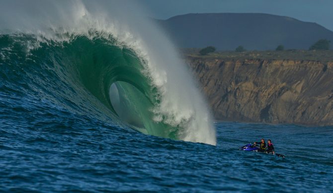
Next winter could be a busy season for Pacific big-wave spots like Maverick’s. Photo: Tony Morin
Climate models are signaling that a particularly powerful El Niño is brewing, likely to form in the second half of the year. If it takes hold, scientists say it could be the strongest we’ve seen in at least a decade.
Researchers are pointing to the strong El Niño events of 1997-1998 and 2015-2016 as a preview of what may be in store: an active storm track across the North Pacific bringing massive waves and atmospheric rivers to California. Historical records suggest we could be heading into an active big wave season on the West Coast, along with a wet winter that delivers bigger snowpacks — a welcome relief after a dry winter.
But Patrick Barnard, Research Director of UC Santa Cruz’s Center for Coastal Climate Resilience, urges caution. How El Niños behave in the era of climate change is increasingly difficult to predict, and future events may not mirror the patterns of the past.
I got Barnard on the phone to try and understand what a Godzilla El Niño could mean for surf, snow, coastal erosion, and more.
People have been referring to the predictions as a potential “Godzilla” El Niño. Is the hype fair?
It’s possible. What I saw from the National Oceanic and Atmospheric Administration (NOAA) is that it’s more likely than not that we’ll get a strong El Niño — 60 percent likelihood. It’s not a rock-solid prediction — and these things are really difficult to predict — but it looks like it’s more likely than not to be a powerful one.
What makes an El Niño?
El Niño affects atmospheric circulation across the entire Pacific and the world. The net effect of that is warm water along the equatorial Pacific gets pushed by winds to the eastern part of the basin, so you basically have all this warmer water pooled up, which affects convection, circulation, storm tracks, water levels, and everything else.
Typically, the (equatorial) winds blow to the west, so they move that warm pool to the central and western Pacific, and when that gets extreme, it’s a La Niña. When it’s in the opposite direction, when the winds shift and start blowing that warm pool to the eastern Pacific, you get an El Niño.
A transition from La Niña to ENSO-neutral is expected in the next month, with #ENSO-neutral favored through MJJ 2026 (55% chance). El Niño is likely to emerge In JJA 2026 (62% chance) and persist through at least the end of 2026. (1/2) https://t.co/5zlzaZ1aZx pic.twitter.com/6Fe9Yl6l86
— NWS Climate Prediction Center (@NWSCPC) March 12, 2026
How could a strong El Niño play out on the West Coast of the U.S.?
We had El Niños of this magnitude in ’82-83, ’97-98, and 2015-16. That’s what they’re predicting is most likely to happen. We’ve looked at a lot of those winter storm conditions over the last 44 years, and typically, what happens is you get higher water levels along the coast of California, half a foot to a foot higher for the whole winter. Storms are going to be right on top of higher sea levels. What’s consistent across all those events is larger wave energy, bigger waves, sometimes 50 percent above average during the winter. That’s the real kicker.
For the more recent El Niños, it’s been a mixed bag in terms of precipitation. For example, 2015-16 was a really powerful El Niño, but we had a drought. We had really big waves, and they caused lots of coastal erosion. But we didn’t get the rainfall that we were accustomed to getting prior to those powerful events.
To summarize, the consistent thing across all those events is much larger waves and very high incidents of beach erosion. What’s been random is the rainfall, and people are trying to understand those atmospheric patterns better. There is a (general) trend of storm tracks moving further north due to climate change. What we may see is that we have massive storms in the Pacific still being generated during El Niños, which bring really, really big waves to California. But the storms (and their rainfall) have been going further north, not hammering Southern and Central California as they have in the past. There really aren’t enough data points to say that’s a long-term trend, or just some observations from the most recent event in 2015-16.
Surfers in California associate an El Niño with more westerly, or even southwesterly, swells. You’re saying that due to climate change, this might not be the case for this upcoming El Niño?
There just aren’t enough data points to know for sure. But, in general, storm tracks are moving further north, and during El Niño, they drop down. But if they’re already starting further north, it’s not going to necessarily be as impactful for rainfall for the southern half of California. What’s been consistent across El Niños is really big waves that come more from the south during these El Niños, but that wasn’t so much the case in 2015-16. There’s been some sort of anomalous behavior that we’re like, “Wait, this doesn’t fit.” For scientists, we have to keep analyzing the data and figuring out what’s going on, and our hypotheses have to be continually tested.
We certainly could have an El Niño that has all those things: really big waves that are more from the south, higher water levels, and lots of rainfall. You get all these atmospheric rivers that come in, and it’s a bit of a roll of the dice in terms of where they hit. That’s hard to predict this far out.
When you said the ocean levels will be half a foot to a foot higher, why is that?
We get this warm pool of water along the eastern Pacific, and then that warm water gets pushed up against the coast and splits — goes north and south, migrating up the coast. Warmer water is less dense. It takes up more room. It’s called the “steric effect.” It raises water levels throughout the whole season. It’s a long-term El Niño phenomenon. You’ve got this warmer water along the coast, so the water levels are higher.
And is that just on the eastern basin of the Pacific Ocean?
Yes. And during La Niña, when you have really warm water in the western Pacific, it piles up on the other side of the basin.
As a result, can we expect some extreme king tides?
If this Godzilla El Niño, as they say, comes to fruition, you basically raise (the ocean’s) base level. So every event, every high tide, you add on top of that. And it just amplifies the impacts you have from king tides and storms. It’s an accelerant to coastal hazards.
As far as the impacts on land, could we say there’d be increased erosion, beach loss, and flooding? Maybe more snowpack in the mountains?
During the 2015-16 event, we didn’t get much rain, but we had everything else — a lot of coastal erosion, coastal flooding. During other events, like ’82-83 and ’97-98, there was a ton of rain, and a lot of snow in the Sierras. What was really damaging about the 2015-16 event is that these big waves hammered the coast, and there was very little rainfall to produce sand in the watersheds to replenish those beaches. It was amid a pretty long drought, and it was not the drought-buster that people were hoping for. There wasn’t all that much rain that particular El Niño. People are still trying to figure out why that was.
What can we expect for the Atlantic hurricane season during a strong El Niño?
My understanding is that El Niños actually reduces the number of Atlantic hurricanes because they increase the wind shear, so these events, especially in the Caribbean, get knocked down and aren’t able to evolve into the big storms. And again, it’s just a probability thing. Hurricanes can still happen, but it just usually means a suppressed hurricane season in the Atlantic. However, the hurricane season in the Pacific usually gets jacked up.
What is the climate science community doing to better understand the new patterns of El Niño and La Niña under climate change?
There are lots of people running global climate models, trying to better understand the evolution of these atmospheric patterns with climate variability, and the models are getting better. I mean, up until five, 10 years ago, they didn’t resolve El Niño and La Niña events very well. They’re getting better and better at doing that. Certainly, NOAA was one of them that was looking at that. Folks like Dan Cayan and the team at Scripps have been trying to understand these patterns. And there are lots of observations — indices that NOAA puts out: the Oceanic Niño Index and the Multivariate ENSO index, which look at atmospheric conditions, temperature in the tropical Pacific, and atmospheric pressure and temperature, for example. So they’ve been tracking those for many, many years and looking at how they’re changing, and then using global climate models to look at what those indices are going to look like in the future.
Some of the more recent studies have suggested that there may not be an increase in the number of El Niño events, but an increase in the more extreme ones, like the one that is likely to happen this winter. We’re going to see an increase in the frequency of the most extreme events because we’ve got warmer atmospheric conditions, warmer ocean conditions, and lots of convection — energy that can be transferred into these more extreme events.
