
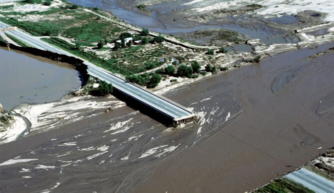
Floodwater from a river swollen with rains during the 1983 El Niño damaged bridges and property in the Tucson, Arizona, area. Photo: TSGT William B. Belcher, courtesy of the National Archives.

By now, you’ve likely heard that we’re probably in for a doozy of an El Niño in 2026. Now, preceding the forecasted weather pattern, the National Oceanic and Atmospheric Administration (NOAA) has released a stark warning about what we might expect if and when El Nino emerges by July.
“It usually ends up being a double whammy,” said NOAA oceanographer and high-tide flooding expert William Sweet, Ph.D. “The first punch is decades of sea level rise, which has waters close to the brim in many coastal communities. And now with this second punch – a strong El Niño – coastal communities face more frequent, deeper and widespread high-tide flooding along both the West and East Coasts.”
If we look back at previous years, a pattern does emerge. In 2015-2016 and 2023-2024, El Niño was particularly strong, and those years brought higher levels of flooding than the norm. Flood risks are higher during El Niño years — especially stronger ones — because as the trade winds weaken across the tropical Pacific, causing Kelvin waves to head east along the equator and up the west coast of the Americas. That warms the upper ocean and raises the sea surface temperatures and sea levels. Kelvin waves aren’t like the waves we surf on. They’re commonly called “planetary waves,” and they’re far larger in scale.
“The geographic extent of an equatorial Kelvin wave is huge,” NOAA explained, “often stretching over much of the Pacific Ocean (thousands of miles).”
Since they affect basically the entire ocean, Kelvin waves also have a direct effect on the complicated system that dictates the planet’s weather patterns that influence everything from flooding and droughts, to cold snaps and heatwaves.
For the western United States, NOAA researchers are particularly concerned about flooding. El Niño brings warmer sea surface temperatures with it, which leads to heavier rainfall. Which, of course, can lead to flooding. The warmer the sea surface, the higher the chances of more precipitation.
“Along the U.S. West Coast, this typically means a wetter, stormier winter, with swollen rivers and saturated ground that can quickly overwhelm drainage systems,” IFL Science explained. “On the East Coast, the effect is subtler but still significant. Elsewhere in the world, the impacts can be very different. In Australia, for instance, El Niño typically brings hotter, drier conditions, raising the risk of droughts, bushfires, and heatwaves.”

