
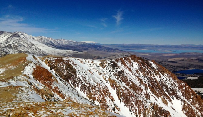
At 11,000 feet in late February there should be a LOT more snow than this in California’s Eastern Sierra. Photo: Nate Deschenes
Whether you’ve been trapped in the polar vortex battling through Snowmaggedon in the northeast, or sunbathing in the unforgiving warmth of the west, you have got to admit that winters have been downright sketchy the past few years. I live and have lived in Mammoth — a place know for regular and abundant snowfall — for nineteen years now, and while I have weathered some off winters, nothing compares to the last four. Previous to this drought, the worst year was far better than any winter that has fallen within this recent time frame. It’s aggravating to say the least, and beyond our pretentious frustrations in the snow sports world, bigger questions are at hand. From local economies like mine which depend on snow and tourism to the more extreme speculations such as recent reports concerning the real possibility of mega-droughts in the western United States, implications are far reaching and very concerning. Whether or not certain townships, industries, and economies may dry up both physically and figuratively is a real possibility if things don’t change.
Consequently, on the other side of the country, New England has taken the brunt of winter’s icy wrath these past four years with record snows falling and frigid temperatures settling in for weeks on end. For the majority of the area’s population, snowboarders and skiers excluded, this means borderline dangerous living conditions as well as extensive socio-economic adversity due to disruption of all manner of commerce.
So what has been going on and why is it happening now? Without exploring the minutia of meteorological details which can give rise to any number of theory, let’s look at what has generally happened the past four winters as opposed to what happens in a typical winter.
The key thing we’re looking at in the United States when it comes to winter weather is the jet stream, or polar jet stream to be more specific.
Typically the polar jet is like a wave which oscillates mildly up and down, back and forth across the continent (and the globe for that matter). Think of everything above the jet stream as cold and snowy and everything below it as warm and dry. This, of course, isn’t entirely correct, but for the sake of simplicity we can assume as much. These bends, called Rossby waves, move back and forth bringing periods of unsettled cold weather as the dip converges into any given region. This is typically followed by a period of drying out and relatively warmer temperatures as the undulation traverses from west to east before the pattern repeated itself. Think of waves at the beach — there are gaps between them. By and large, this has been the normal way a winter weather pattern works, at least for our epoch in history.
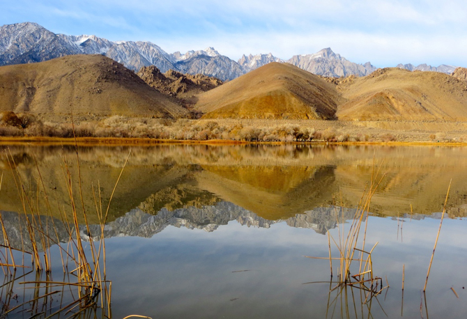
The Southern Sierra is in even worse shape with the lower 48’s highest peak, Mt. Whitney (far right) almost barren of snow. Photo: Nate Deschenes
When this pattern is disrupted, droughts and deluge occur.
And this is exactly what has been happening. Instead of regular intervals ebbing and flowing, the waviness of the jet stream has become stuck in place locking in extended periods of extreme weather with respect to the geographic location. In the case of the past few winters, the jet has not only become stubbornly stationary but the wave itself is amplified coming down from Canada through the midwest and dipping far south before rising back up again over the Atlantic. This creates a giant catchers mitt trapping cold arctic air and subsequent snowfall above the entire eastern third of the country. Conversely, everything west of the dip is locked in an opposite pattern, unusually warm and dry, disastrous for not only skiers and snowboarders but for an ecosystem which depends on the winter rains and snow for the bulk of its annual precipitation. So if we look at this like an ocean wave again we would see a giant single wave that moved achingly slow towards the shore before it finally crested and broke, allowing for another set to move in only after its stubborn dynamics were reconciled in due time.
For the past four years the jet stream has done exactly this until sometime in March. The first two-thirds of winter are relentless on the east coast while the last push going into spring shifts into a more favorable pattern for storms to approach California and western states. This is hardly sustainable for a myriad of ecological and economical arrangements which have been dictated over time by a previously fairly dependable weather pattern.
Throughout history, droughts are commonplace and often part of a lager scale pattern at work, yet the severity and duration of this tweaked jet stream has given rise to all sort of speculation as it is breaking records across the board. In the eyes of many climatologists, the symptoms of this amplified jet stream can no longer be dismissed by atmospheric oscillations like El Niño or La Niña which on any given year can account for prolonged periods of extreme weather divergent from the norm.
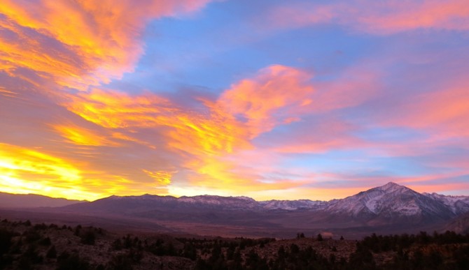
An Eastern Sierra sunrise that looks more typical of October, not February. Photo: Nate Deschenes
Instead, they are looking at something called Arctic Amplification.
This is a fancy way of saying that the arctic sea ice is melting and the more exposed water absorbs the suns heat rather than reflects it back into the atmosphere in turn raising the temperature in the Arctic region faster than the temps in lower latitudes. Like El Niño, this imbalance creates extreme rise and dips in the jet stream, unlike El Niño, this is not an anomalous event that happens once or twice every ten years but instead is an irreversible consequence of global warming. What’s so concerning is that once sea ice starts melting and the ocean starts absorbing more solar heat every year (which it has the past 30 years) the effect is that of a runaway train picking up more speed with each passing second.
Only time will tell however, if this is just a prolonged, random occurrence in the weather as we know it, or if it is something much worse.
