
WMO is predicting a rare “triple-dip”La Niña phenomenon, where La Nina conditions persist for three consecutive years. Image: NASA
The World Meteorological Organization (WMO) is predicting that the current La Niña phase will likely continue for the next six months, making it a rare triple-year La Niña and the first of the century.
“It is exceptional to have three consecutive years with a La Niña event,” Professor Petteri Taalas, WMO Secretary-General, said in a statement.
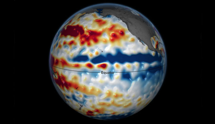
While both El Niño and La Niña phases are complicated weather patterns, in short, they refer to the rise and fall of temperatures in the eastern Pacific Ocean. The cooling phase is La Niña while the warming phase is El Niño. During an El Niño year, the warmest waters in the Pacific gather at the northern end of South America. These ocean temperature fluctuations drive global weather events.
“La Niña is a weather pattern that begins in the Pacific Ocean,” NASA explained. “Warm ocean water and clouds move west during a La Niña. This means that places like Indonesia and Australia can get much more rain than usual, and places like the southwestern United States can be very dry.”
Known as a “triple-dip,” a three-year La Niña stint has only occurred three times since record keeping began: from 1954 to 1957, 1973 to 1976, and from 1998 to 2001. It’s expected to affect weather conditions around the world, deepening the drought in Africa and causing yet another extremely wet summer in Australia.
“The worsening drought in the Horn of Africa and southern South America bear the hallmarks of La Niña, as does the above average rainfall in Southeast Asia and Australasia,” Taalas explained. “The new La Niña update unfortunately confirms regional climate projections that the devastating drought in the Horn of Africa will worsen and affect millions of people.”
According to The Bureau of Meteorology, the triple-dip will have devastating effects, particularly on Australia’s east coast. Severe flooding and cyclones are likely.
“Historically, La Nina conditions tend to bring cyclone tracks closer to the east Australian coast and further south than they would usually occur, bringing increased risk of cyclone damage,” said Professor Mark Howden, the Director of the Australian National University Institute for Climate, Energy and Disaster Solutions.
Thankfully, though, there is relief in sight. The Bureau of Meteorology believes that after the current phase runs its course, it’s likely we’ll return to neutral conditions by early 2023.
