
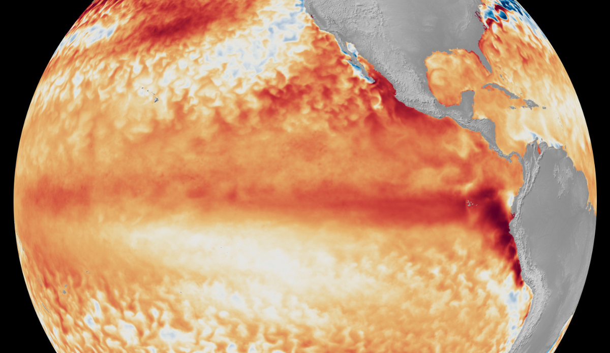
Satellite imagery showing the difference from average sea surface temperatures at the equator in the tropical Pacific Ocean (depicted using various shades of red and orange for warmth) during the first week of June 2026, as compared with the baseline used by NOAA’s Coral Reef Watch. Photo: NOAA Satellites
El Niño is officially here and it’s probably going to be an intense one, forecasters from the National Oceanic and Atmospheric Administration (NOAA) declared Thursday. The administration published its official announcement of the climate event after months of monitoring conditions in the equatorial Pacific, which included increasing expectations that this particular El Niño would strengthen throughout the year.
Those proclamations have prompted media outlets to label the event with monikers like “Super El Niño” and “Godzilla El Niño.” Neither is considered a scientific term used by NOAA forecasters that simply acknowledged on Thursday the event is expected to intensify to a moderate or strong level during the fall. There is a 63 percent chance it will develop into a “very strong” climate event.
The arrival of this El Niño has been monitored by scientific organizations globally for several months now. NOAA’s Climate Prediction Center sounded the alarm as winter was winding down and issued its first official El Niño watch advisory in early April. When the European Center for Medium-Range Weather Forecasts released its own April report, an atmospheric scientist at the University at Albany named Paul Roundy said early signs suggested this would have “real potential for the strongest El Niño event in 140 years.” Weeks later, the United Nations’ World Meteorological Organization (WMO) predicted the climate event had potential to form by May, and it appeared to be a consensus in the scientific community this El Niño would last through the rest of the year and the winter months of early 2027.
“Every El Niño is not the same; each one is unique with its own imprint on our weather,” said Ken Graham, director of NOAA’s National Weather Service (NWS). “Advanced monitoring and an improved understanding of El Niño patterns allow the NWS to better predict and better prepare the public and our core partners for what is to come.”
Of course, everybody always wants to know, “how will this impact the summer and winter where I live?”
NOAA outlined five typical impacts of El Niño:
– Suppressed hurricane development in the Atlantic Basin (Atlantic Hurricane Season runs June 1 to November 30) and enhanced tropical development in the eastern and central Pacific (waves!).
– Stormier weather in the Southern U.S., increasing chances of rain and snow.
– Higher risks of high-tide flooding on the U.S. West Coast.
– Changes in marine life migration patterns. Warm water species move north while cold water species move even further north and into deeper waters (a pattern influencing shark activity in California this year)
– The formation of algal blooms along the U.S. West Coast.
