
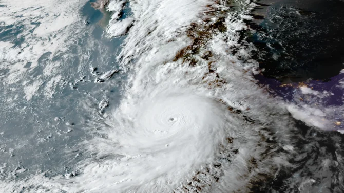
Hurricane Polo has quickly become the strongest of the season. Photo: NOAA//CIRA

The warm, El Niño-supercharged waters of the Pacific Ocean are rewriting what storms are capable of. Polo strengthened from a tropical depression to a Category 5 hurricane faster than any other hurricane ever recorded.
Scientists at the National Hurricane Center called Polo’s intensification “truly remarkable” and “catastrophic.” In 42 hours, Polo, barely a tropical depression, became a Category 5 storm with sustained wind speeds of 180 mph. It became the third Category 5 storm of the season, and one of the strongest hurricanes ever recorded in the Western Hemisphere. The strongest was Hurricane Patricia in 2015, which had wind speeds of 215 mph.
Luckily, the storm is far enough off Mexico to spare coastal towns from the brunt of the damage. But the National Hurricane Center still warns of large waves and as much as eight inches of precipitation in the state of Guerrero through Thursday.
Polo is currently on a northwesterly track along the Mexican coast, expected to remain a major hurricane for the next few days. There is uncertainty around what track the storm will take later in the week. Some models suggest it will make landfall in Baja California. Others suggest it will drift out to sea.
The track it takes will be crucial for surfers in Southern California wondering if they’ll get any surf from Polo. Most models agree that it will come close to the Southern California swell window. The storm could get past the Vizcaíno peninsula and generate steep, south-southeasterly swell.
While the Eastern Pacific continues to pump out major hurricanes, all is quiet in the Atlantic. It’s been 112 years since the Atlantic Ocean last went this late into the season without a hurricane. The years 1907 and 1914 are the only times the Atlantic had no recorded hurricanes.

